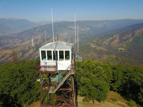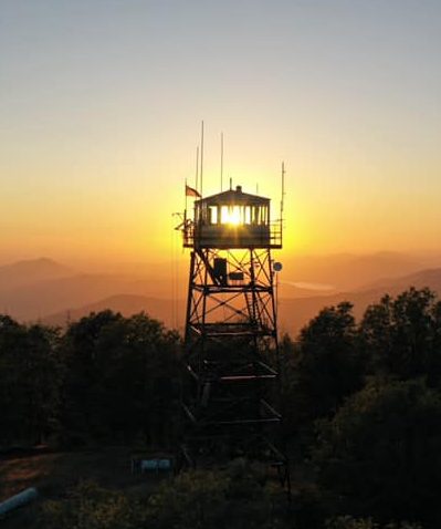
Delilah Lookout is IN SERVICE for the 2023 summer season.
Elevation: 5176 Feet
Sequoia NF
California, USA
LAT/LONG 36˚ 48’ 15” X 119˚ 07’ 03”
TOWNSHIP 13 SOUTH, RANGE 26 EAST
SECTION 11
Delilah Lookout History (updated 2/2019)
Delilah Lookout, elevation 5,156, is located on Pine Ridge in the northern most
portion of the Sequoia National Forest in the Southern Sierra. It’s location on the
edge of a narrow ridge affords it dramatic views of the Sequoia and Sierra National
Forests, Kings Canyon National Park and the lower Kings River watershed as it flows
into Pine Flat Reservoir.
Delilah was established in 1916 as a site for fire detection and may have had several
incarnations. What is thought to be the first is a small 7×7’ observation cab perched
on a metal tower with access to the top via a ladder that clung to the side of the
tower. Fire-watchers lived in a ground cabin down below. In 1933, the CCC’s at
Camp Millwood were given a Project Work Order, which included building a new
lookout on Delilah Ridge, constructing the McKenzie Guard Station and making
improvements to the Delilah road. In 1937, Hume Lake District Ranger Norman
Norris submitted a recommendation to replace the current lookout with a shorter
tower and larger live-in cab. There is no conclusive evidence that either of these
proposed lookouts were ever built.

In 1960, the observation only lookout was replaced with a very unique fire lookout –
a spacious 15×15’, 67’ tall decommissioned air traffic control tower, flown in from
Lemoore Naval Air Station and reconstructed at its current location. Funded by
both the Forest Service and the State of California, Delilah was staffed annually
during fire season until 1999, when Buck Rock became the primary lookout for the
district and Delilah was closed. The lookout was temporarily re-opened during the
Highway Fire in August of 2001, and was again staffed in 2002. With the advent of
the Buck Rock Foundation Volunteer Lookout program, Delilah saw renewed life
and has been regularly staffed by volunteers since 2005. In 2011, the Buck Rock
Foundation in partnership with the Fresno County Resource Advisory Committee
and the US Forest Service completed a 2-year renovation of the lookout cab. The
lookout was directly threatened by the Rough Fire in 2015, but was saved when
firefighters successfully stopped the westward progress of the fire right along the
ridge where Delilah is perched.
Delilah is typically staffed and open to the public 7 days a week during fire season
from Memorial Weekend through the end of October. Visiting hours are from 10:00
a.m. -5:30 p.m. Access to the lookout is via a rocky dirt road – 4 wheel drive or high
clearance vehicles are recommended. There is no public camping on the site.
HOW TO GET HERE:
Please check road conditions before traveling. Take Highway 180 east from Fresno. Drive through Squaw Valley and Dunlap, where you will pass the Hume Lake District Office. From there it is 8.8 miles to the turn off, Millwood Road (the sign will mention McKenzie Helispot). Drive northwest approximately 2 miles on FS 12S01 to FS12S19, which veers left and stays on top of the ridge through Sequoia Highlands Camp, then turn onto the Delilah Road FS 13S75, which splits to the left, 2 miles to the lookout.
